Kangaroo Island, South Australia, 5 July 2024.
(Recent Posts, Top Posts, Subscribe and Search at bottom of page. Clicking image doubles size (on PC). Trip summary and posts.)
.
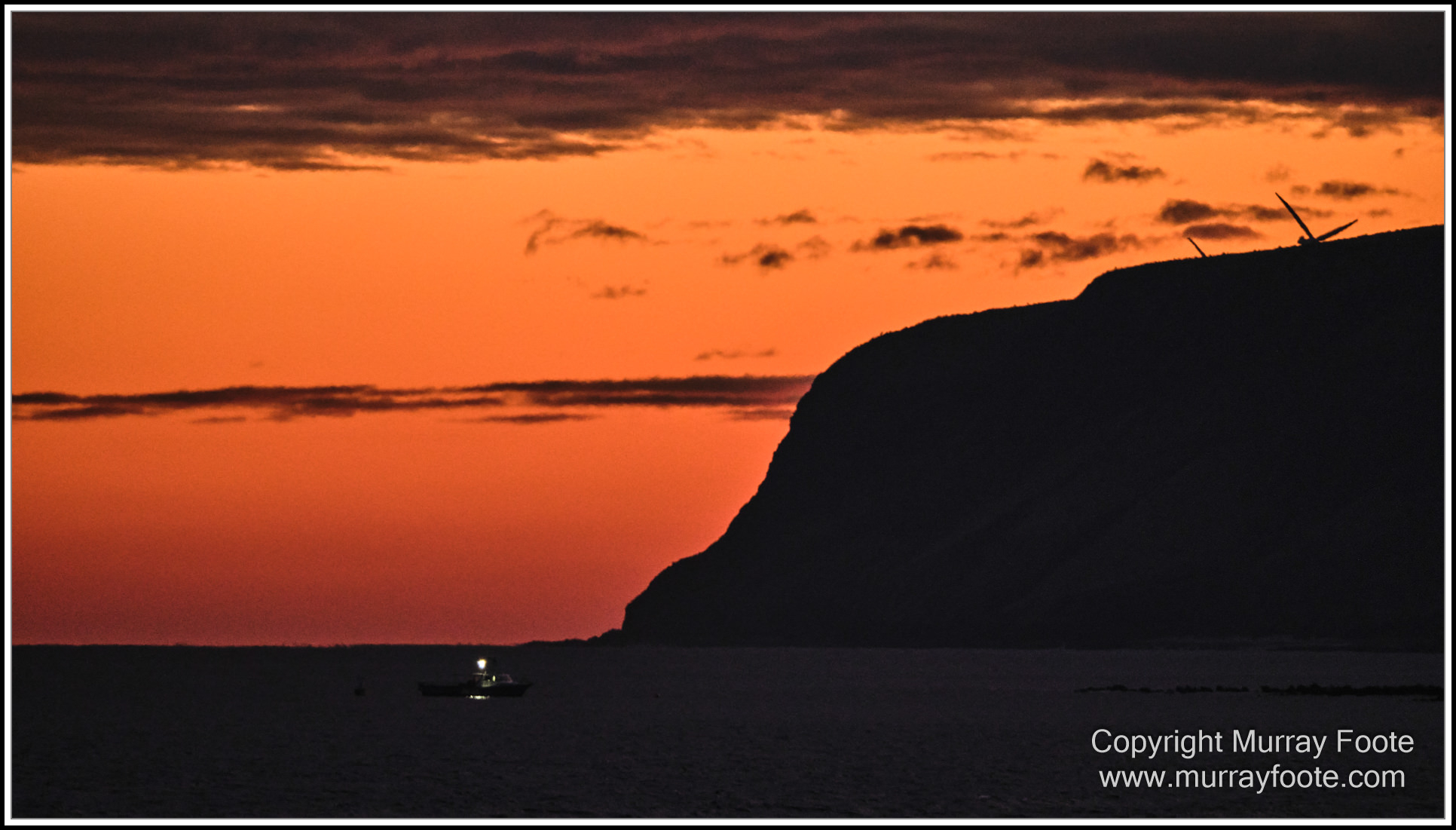
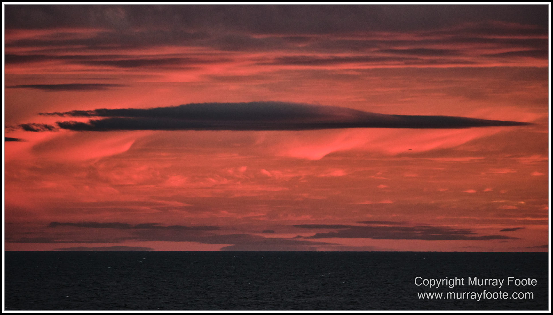
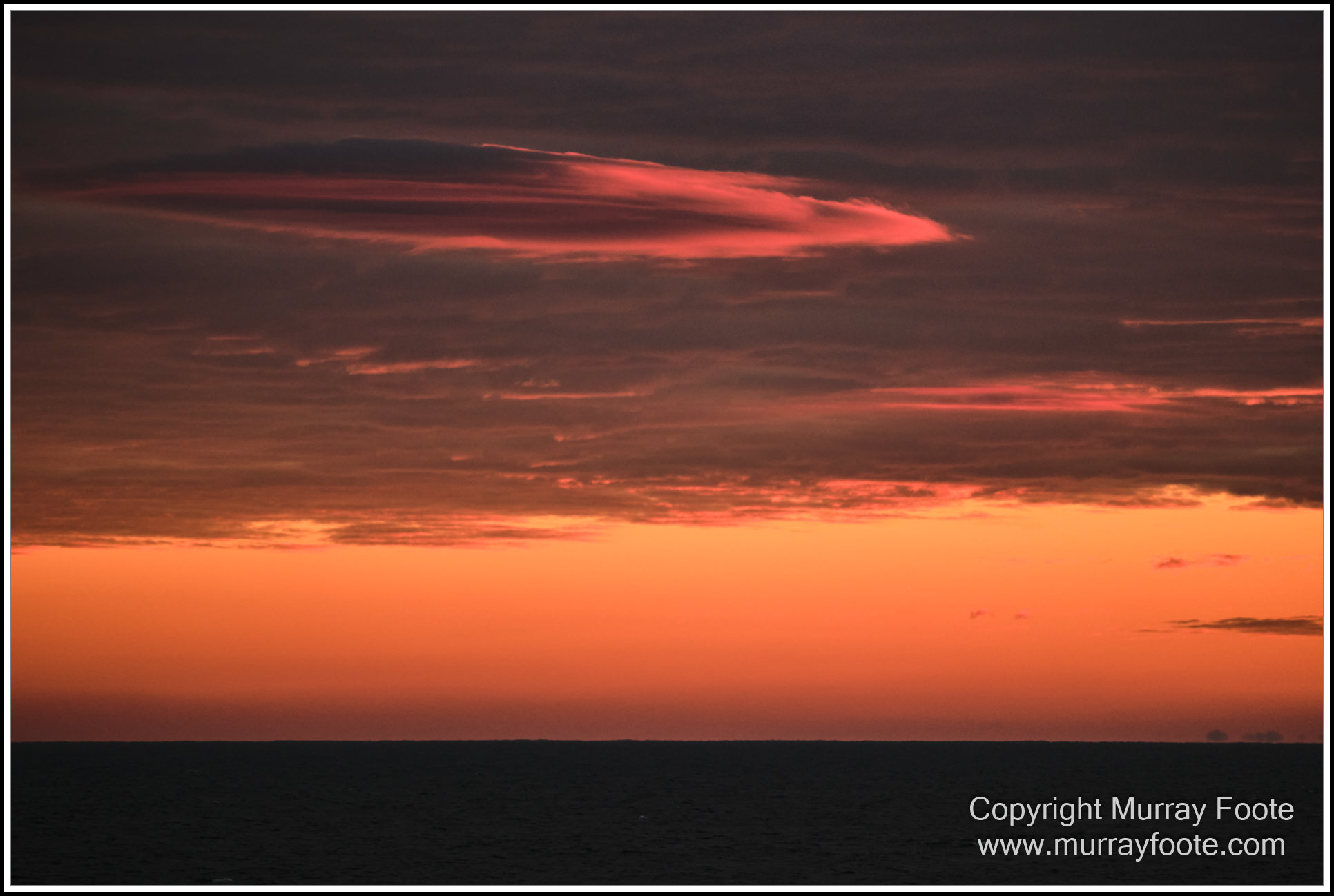
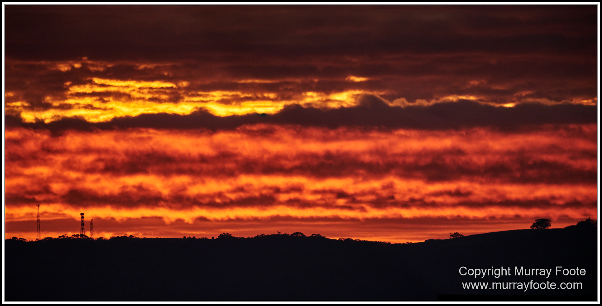
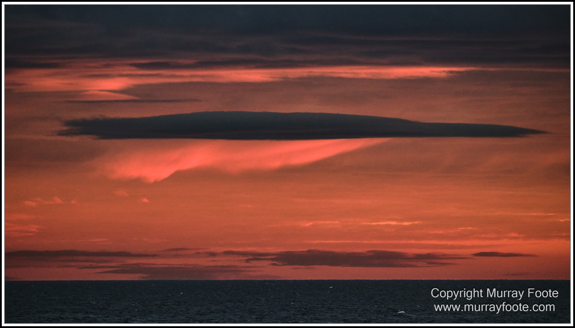
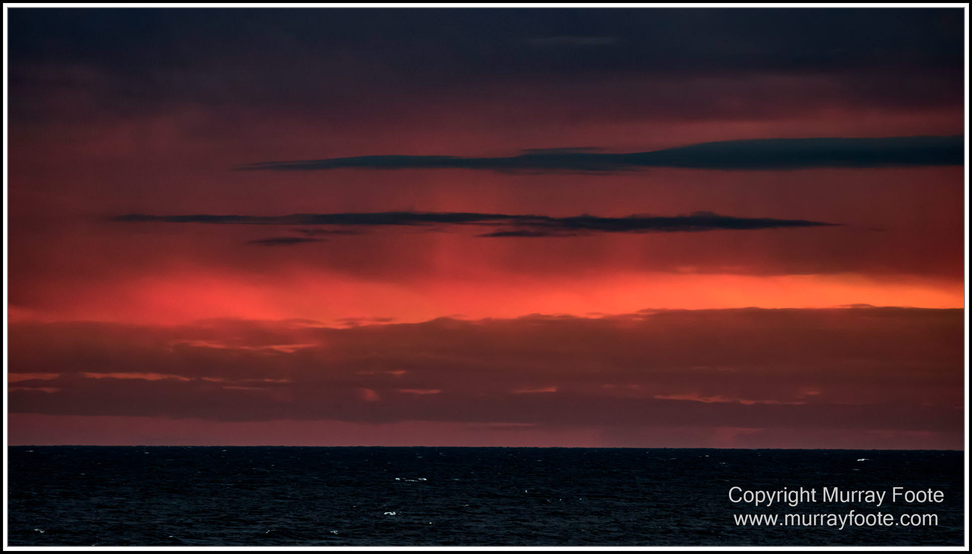
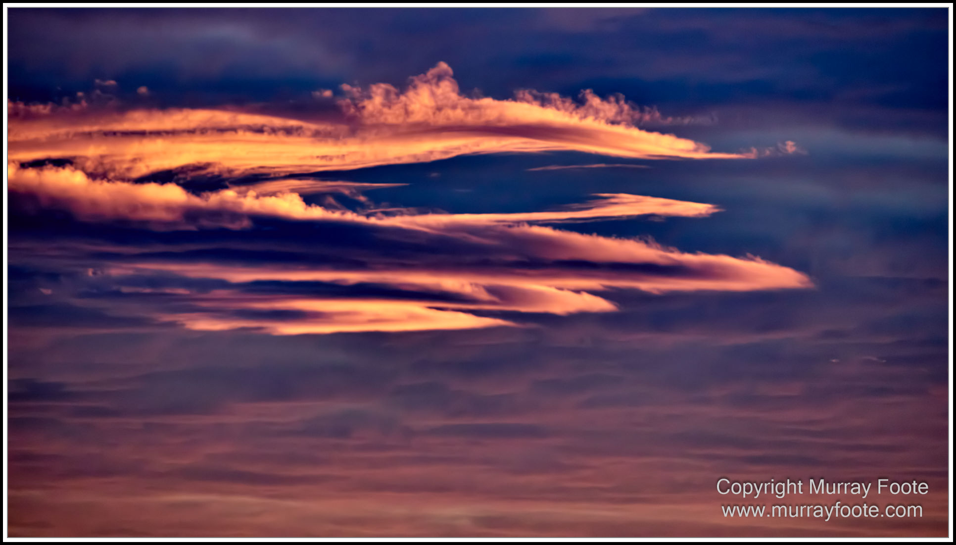
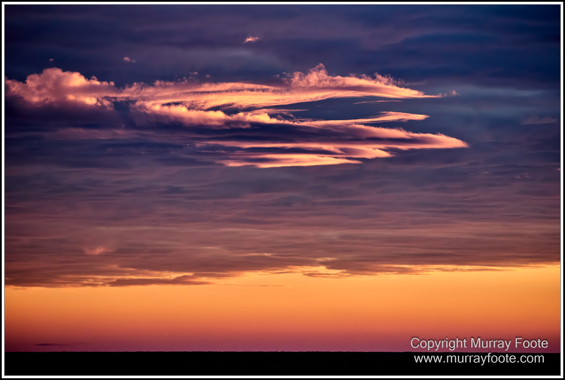
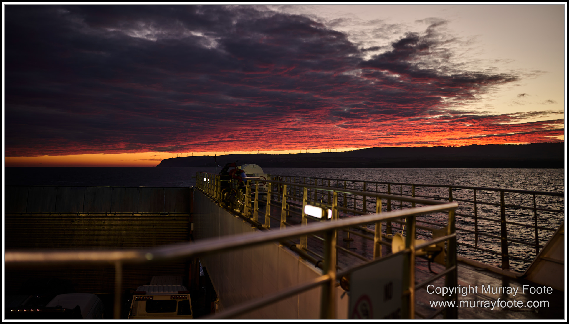
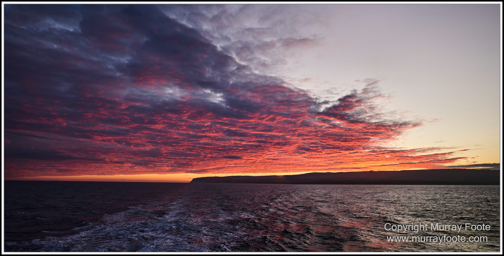
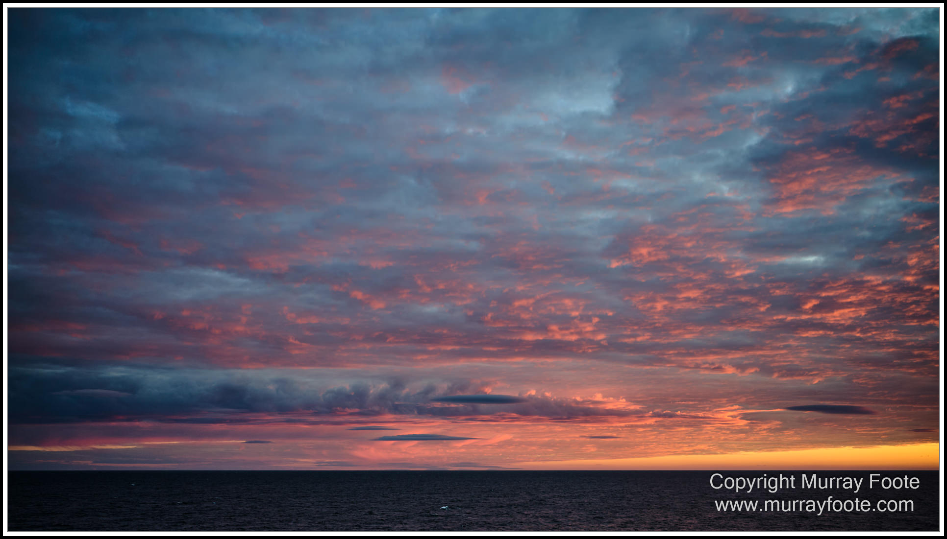
We left Cape Jervis for Penneshaw before dawn, accompanied by some celestial fireworks.
.
.
.
.  .
.
.
.
.  .
.
.
.
.  .
.
.
.
.  .
.
.
.
.  .
.
.
.
.  .
.
.
.
.  .
.
.
.
.  .
.
.
.
.  .
.
.
.
.  .
.
.
.
. 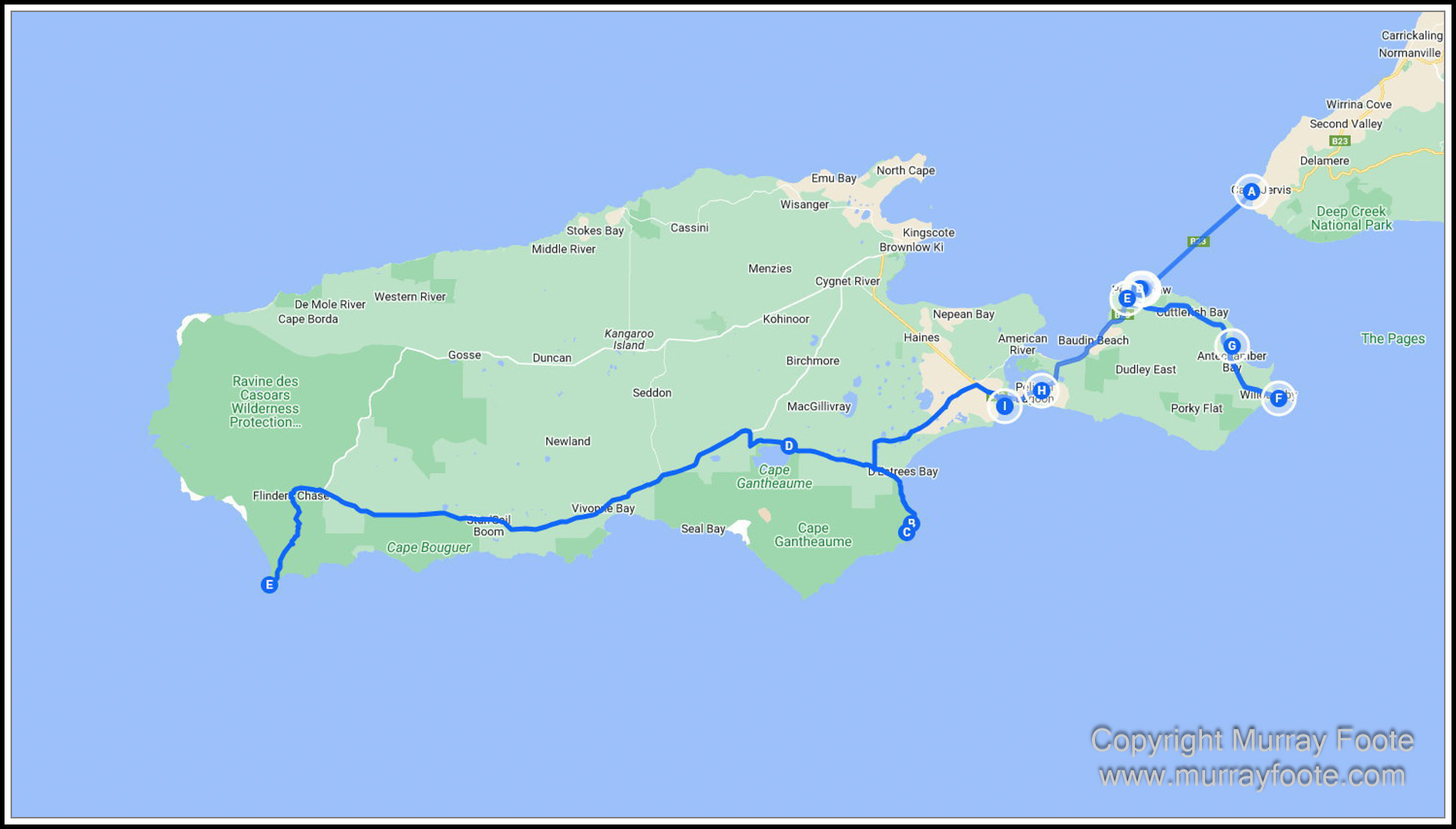
Route for the day.
First, ferry from Cape Jervis (A) to Penneshaw. I had booked a boat ride with dolphins and seals at Penneshaw but that was cancelled due to wind, so instead we went to Cape Willoughby Lighthouse (F). From there we went to Pennington Bay (I) and then down the east coast to D’Estrées Bay (C (two routes combined from Google MyMaps)). We had a wetlands walk planned at Lake Murray (D) but ran out of time for that so drove directly to our accommodation at Cape Du Couedic (E).
.
.
.
.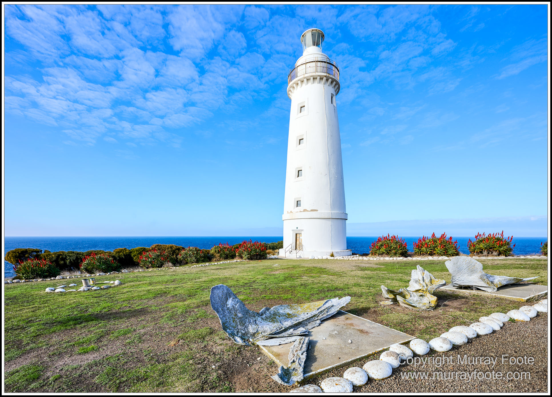
Cape Willoughby Lighthouse with whale bones in the foreground.
.
.
.
. 
The path to Cape Willoughby Lighthouse with red hot pokers (kniphofia).
.
.
.
. 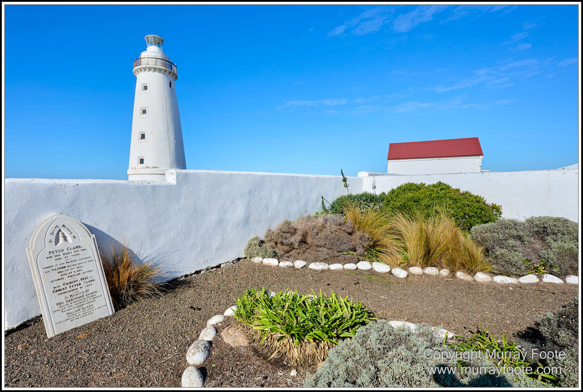
Lighthouse Garden.
The lighthouse cottages garden, protected by a solid wall against wind and salt spray. There is also the tombstone of Peter Clark, a lighthouse keeper who died suddenly in 1891 at the age of 67, and also his wife and some descendants who died later.
.
.
..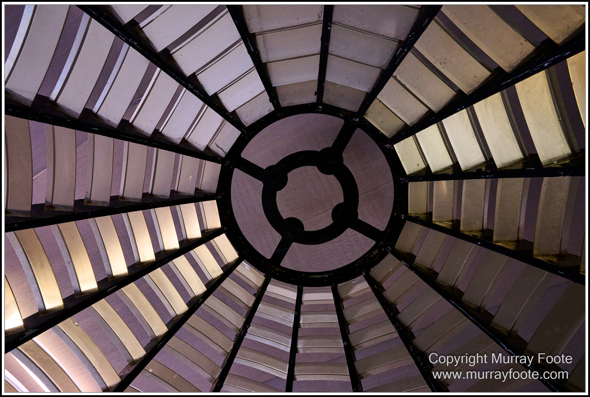
Old lighthouse Fresnel Array.
At one time Australian lighthouses focused the light using a fresnel array, such as we are looking up at here. This was rotated by a clockwork mechanism that sat in a bed of mercury and powered by a weight that hung down the centre of the lighthouse. Before I visited during the From Dusk Till Dawn project in 1987, this had been replaced by an electric system. So we are looking up through this in a storeroom.
.
.
.
.

Looking through the array at several objects, including spectra and an old “Hobart Town” brick.
.
.
.
. 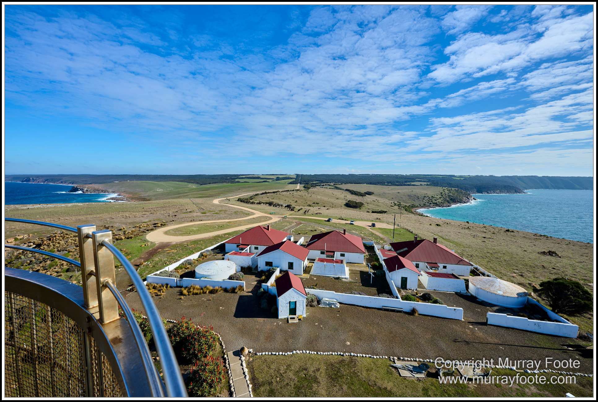
The lighthouse cottages from the lighthouse.
Generally, three families stayed at Australian lighthouses for three eight-hour shifts.
.
.
.
. 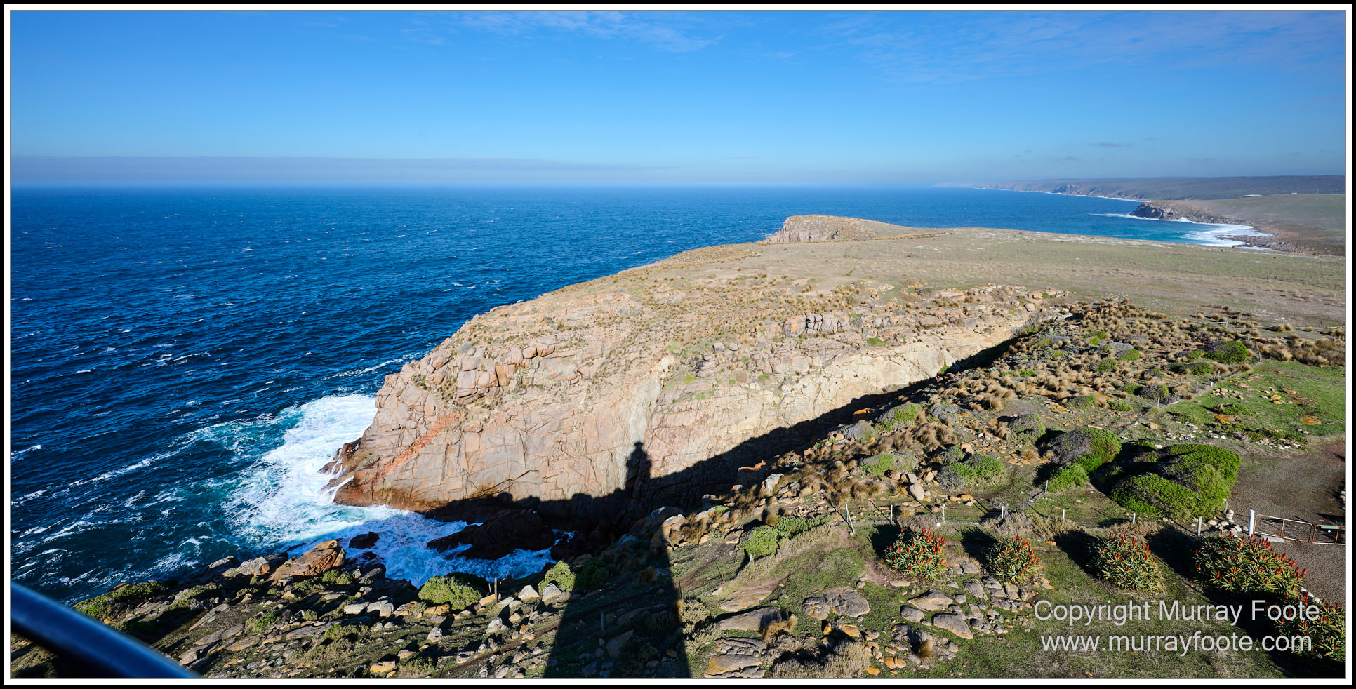
Devil’s Kitchen and Lighthouse shadow.
To photograph the lighthouse in 1987, I reconnoitred before dark and then went part way down the cliff at the far side of Devil’s kitchen before dawn, perhaps somewhere near the top of the lighthouse shadow. (refer Trip Itinerary for that image).
.
.
.
. 
Pennington Bay (this and next two images).
This image is looking north and the next two look south, from different points along the road.
.
.
.
.  .
.
.
.
.  .
.
.
.
. 
A small pink lake at the side of the road.
.
.
.
. 
Cape Gantheume Conservation Park (also, remaining images).
This is a “random” coastal location on the south east coast of Kangaroo Island, where we found a place to park. It is probably not far from Wright’s Ruin which we looked for but did not find.
.
.
.
. 
Same location, looking south rather than north.
.
.
.
. 
Osmanii Reef, off Point Thinline.
The Osmanii, an “iron-screw steamer” struck this reef in 1853. 48 passengers and 35 crew members made it to shore and survived.
.
.
.
. 
Threshing floor.
Wheat and barley were once grown in this area, which seems unlikely today. This threshing floor was built in the late 19th century and used until around 1930. Horses with their hooves covered in hessian bags walked over the cut stalks to separate (thresh) the grain head from the stalks. A hand turned winnower was then used to separate the grain from the chaff. Then the grain was bagged and carted to either Kingscote or American River for shipment.
“There were three men came out of the West
Their fortunes for to try
And these three men made a solemn vow:
John Barleycorn must die.”
(Traditional/ Traffic).
.
.
.
.
. 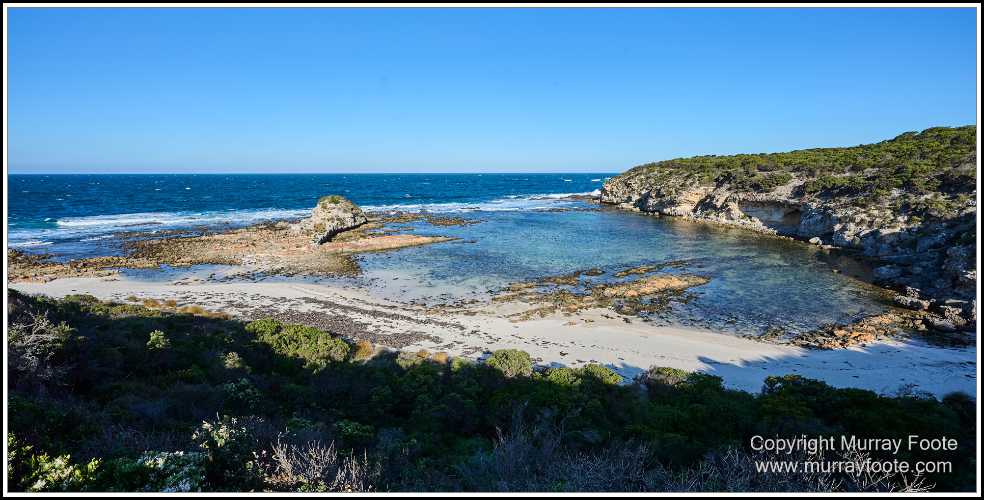
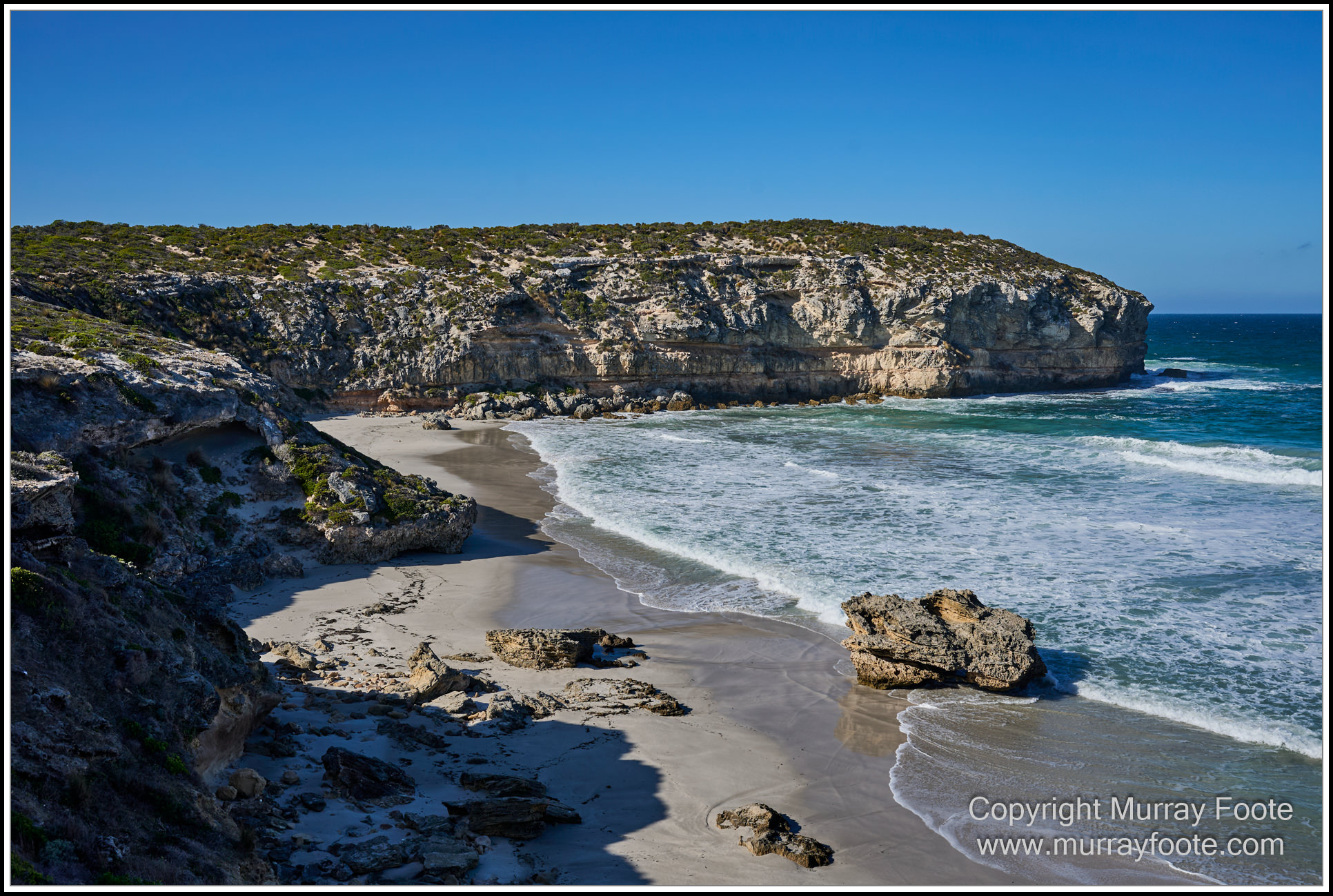
Tadpole Cove.
I think the Tadpole is the big rock in the middle of the cove bordering the waves.
.
.
.
. 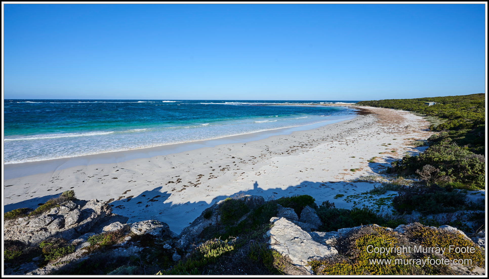
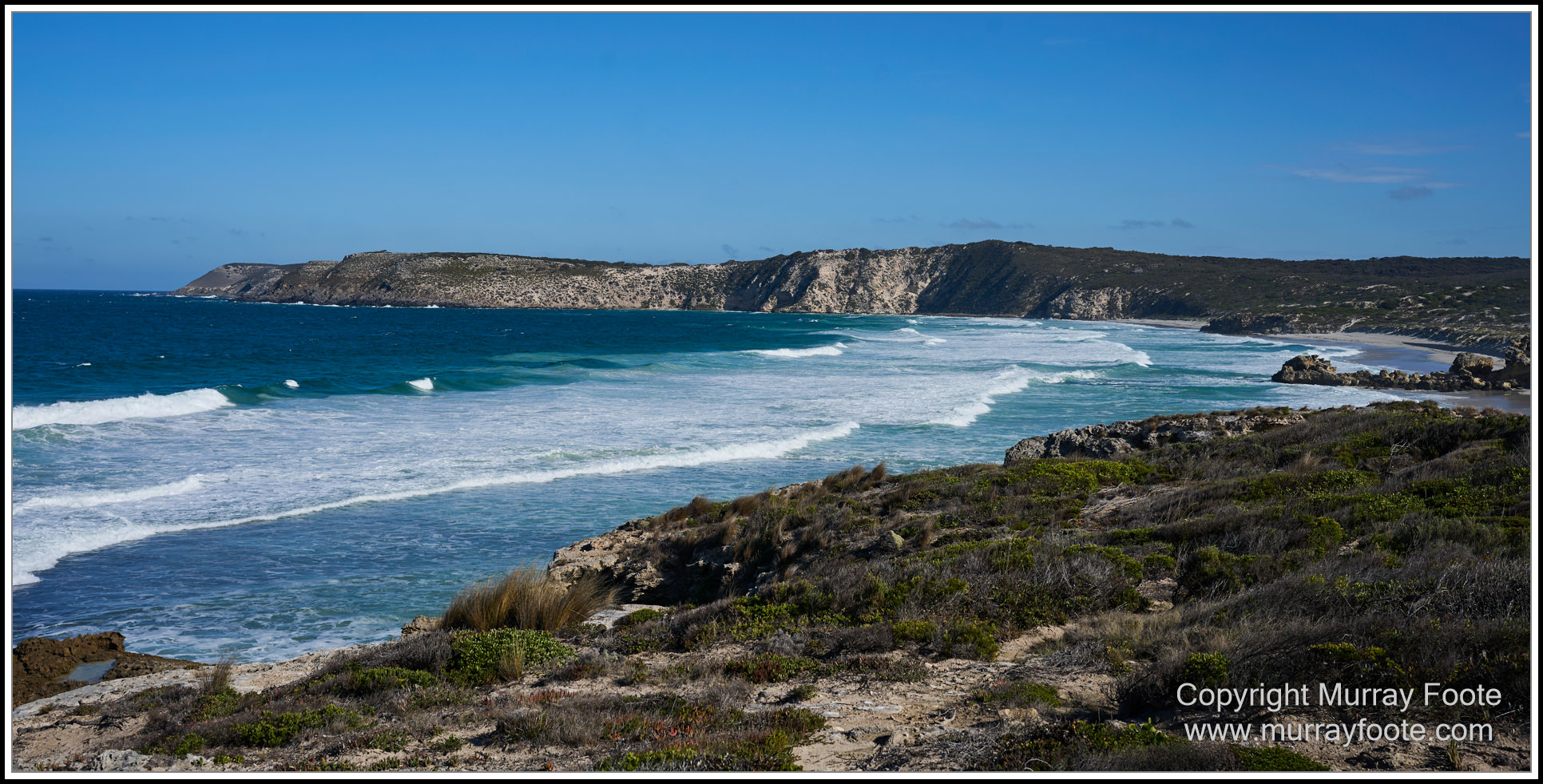
Wheaton’s Beach (looking south).
.
.
.
. 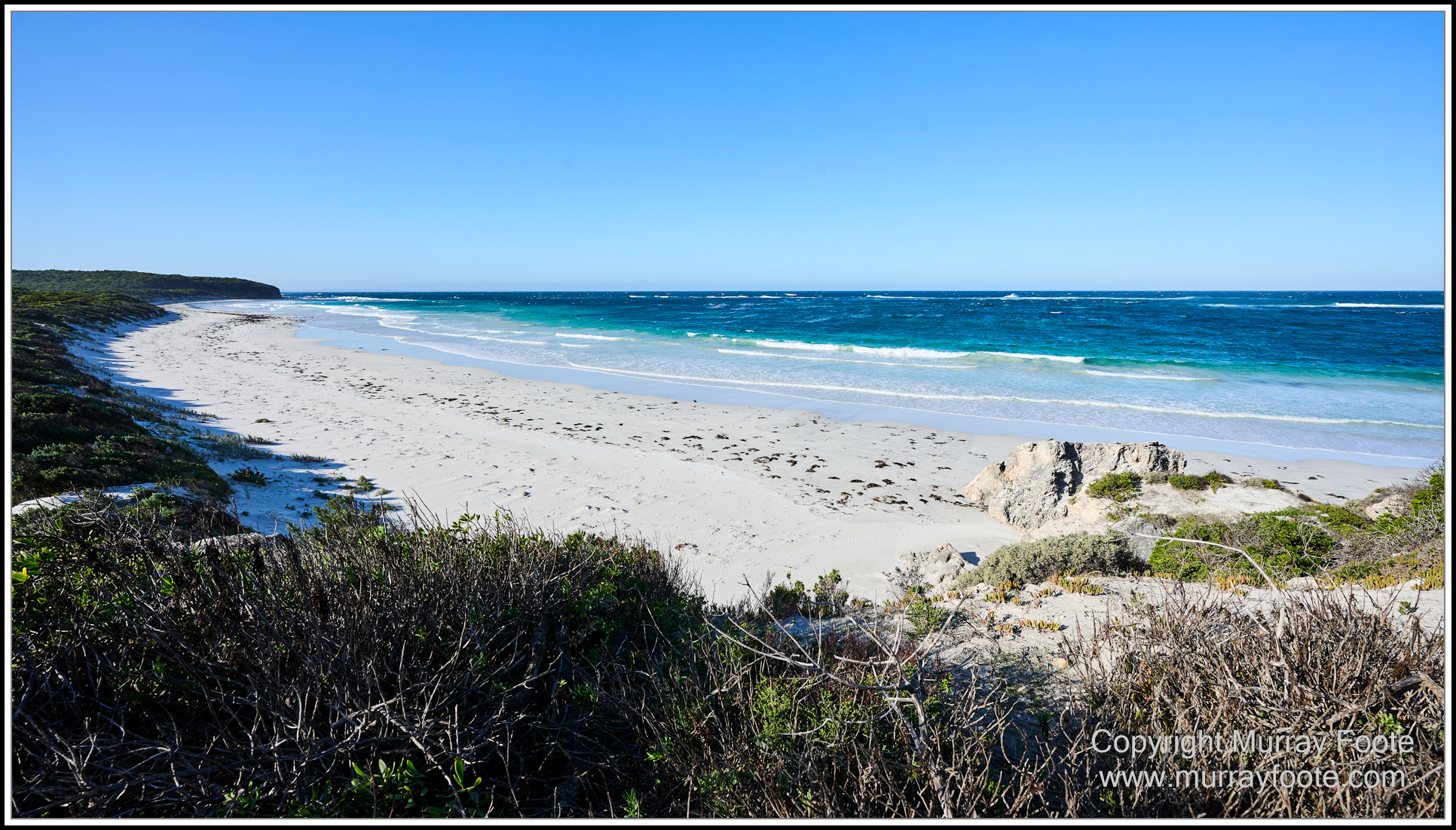
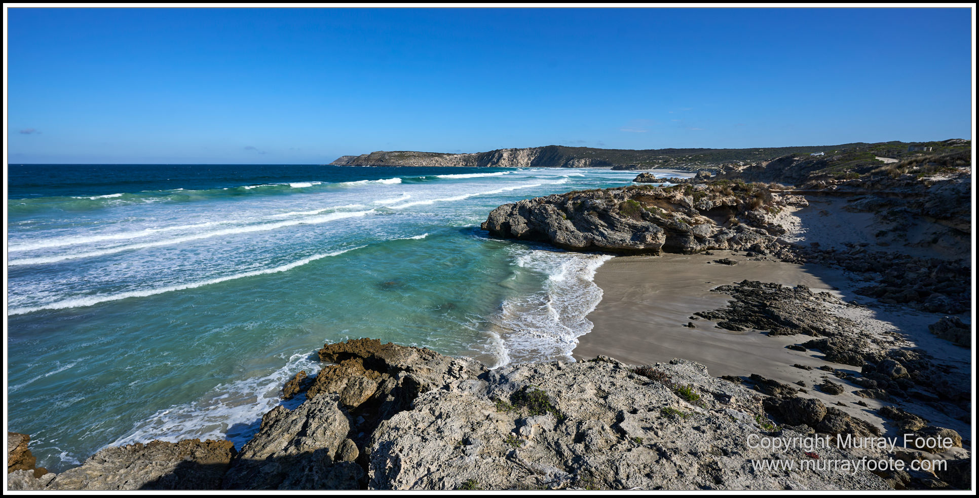
Wheaton’s Beach (looking north).
White sand beach with no people. You might have noticed that. It’s not a through road so you have to decide to come here. I don’t think I saw another vehicle in the couple of hours we were on this coast. It is winter though. There might be one or two people here in summer, so a bit more like Bondi then, and there is a campground not far away (unoccupied at this time).
.
.
.
I have a few more images to show you of Admiral’s Arch when we arrived at Cape Du Couedic at the end of the day’s journey, but they will come in a later post for the Cape.
.
.
