Dhilba Guuranda–Innes National Park, South Australia, 14 July 2024.
(Recent Posts, Top Posts, Subscribe and Search at bottom of page. Clicking image doubles size. Trip summary and links to posts ..)
.

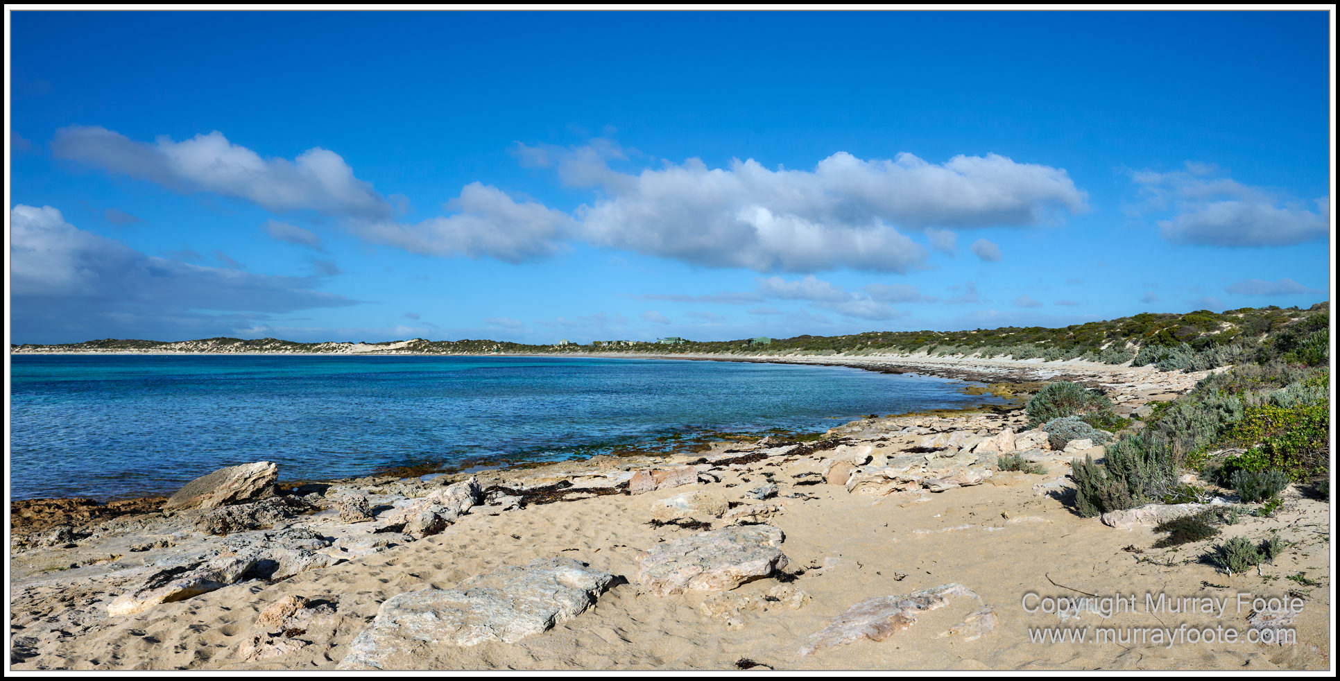
We are heading towards the west coast of Dhilba Guuranda–Innes National Park. I think this must be cliffs to the west, taken from the Ethel Beach Lookout.
.
.
.
. 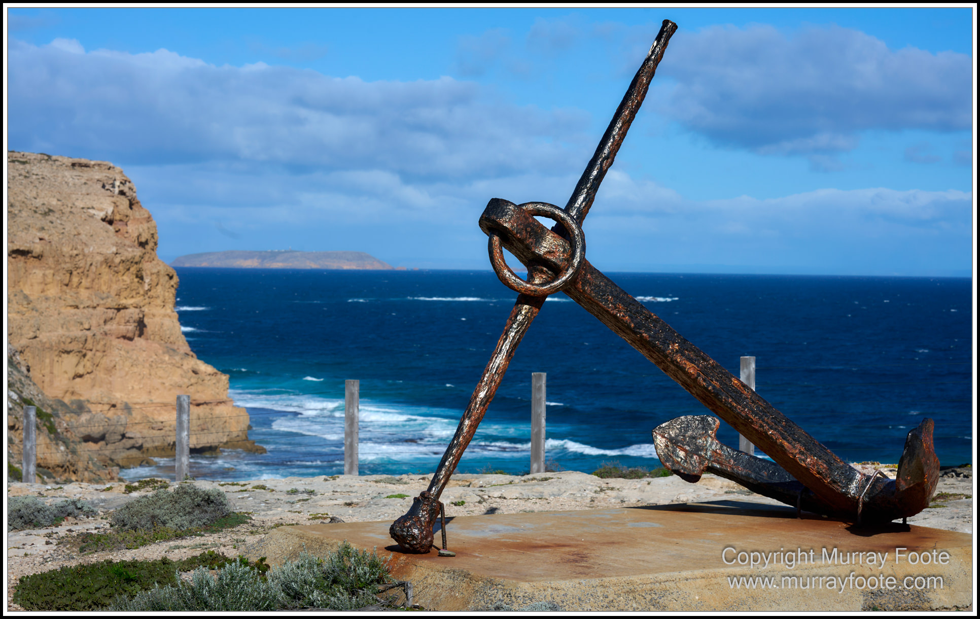
An anchor from the wreck of the Ethel, at the lookout above the beach (see earlier post).
.
.
.
. 
We are now at West Cape Lookout again, looking east along the beach, Althorpe Island at far right.
.
.
.
. 
Looking down on West Cape rocks.
.
.
.
. 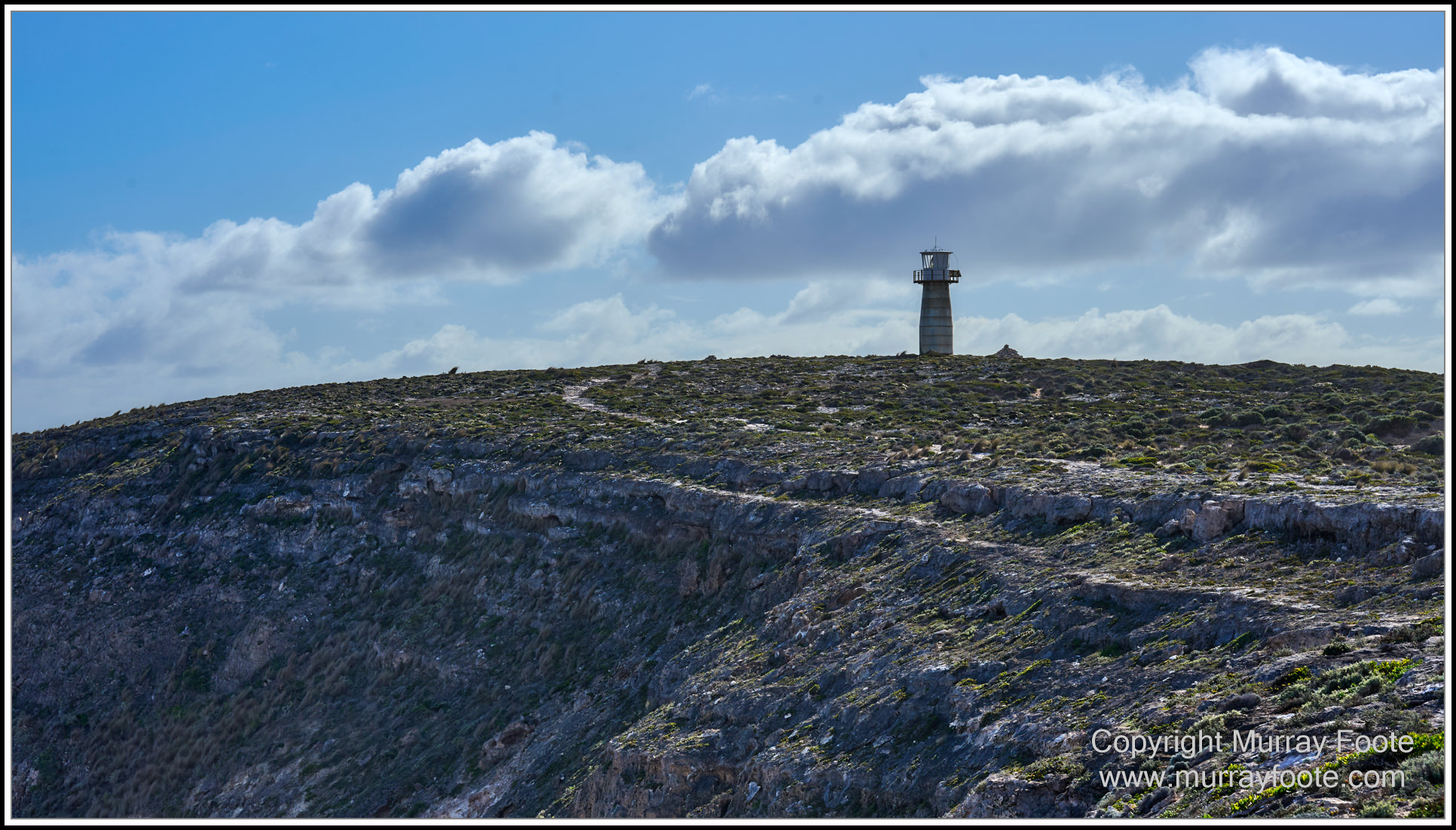
West Cape Lighthouse.
It is very exposed here and the gales can be ferocious. You are warned not to walk here when the wind is up or you may get blown off the edge.
.
.
. 
West Cape Lighthouse.
.
.
.
. 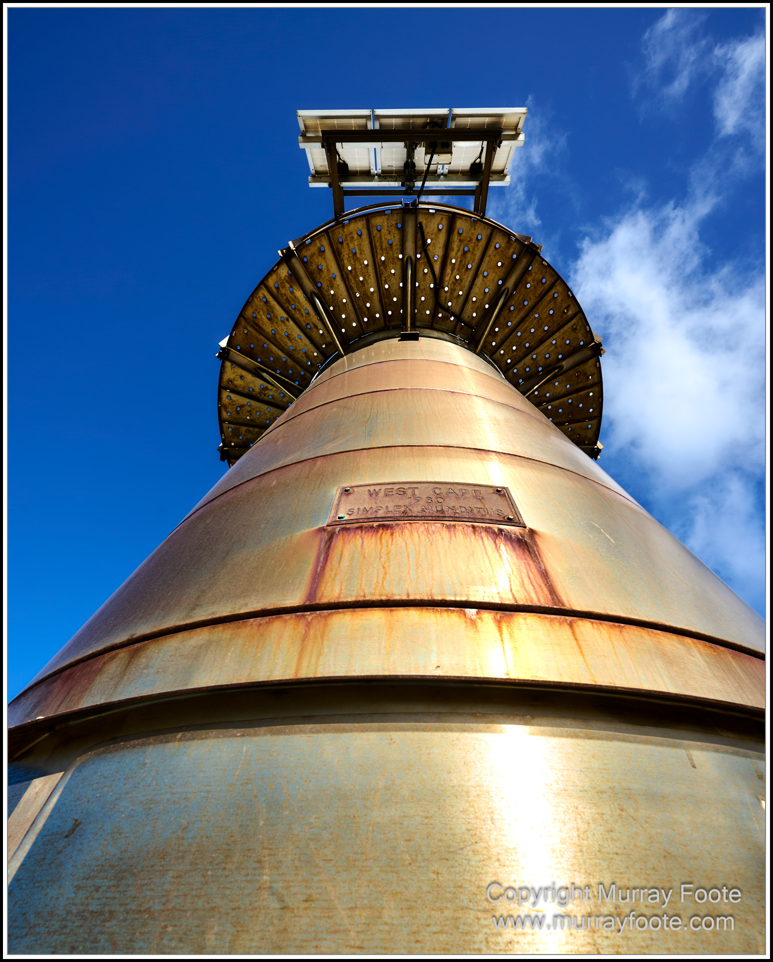
West Cape Lighthouse, looking up.
The plaque says “West Cape 1980 Simplex Munditiis”. (Simplex Munditiis means simple and unadorned. Its associations includes a poem by Ben Johnson).
.
.
.
. 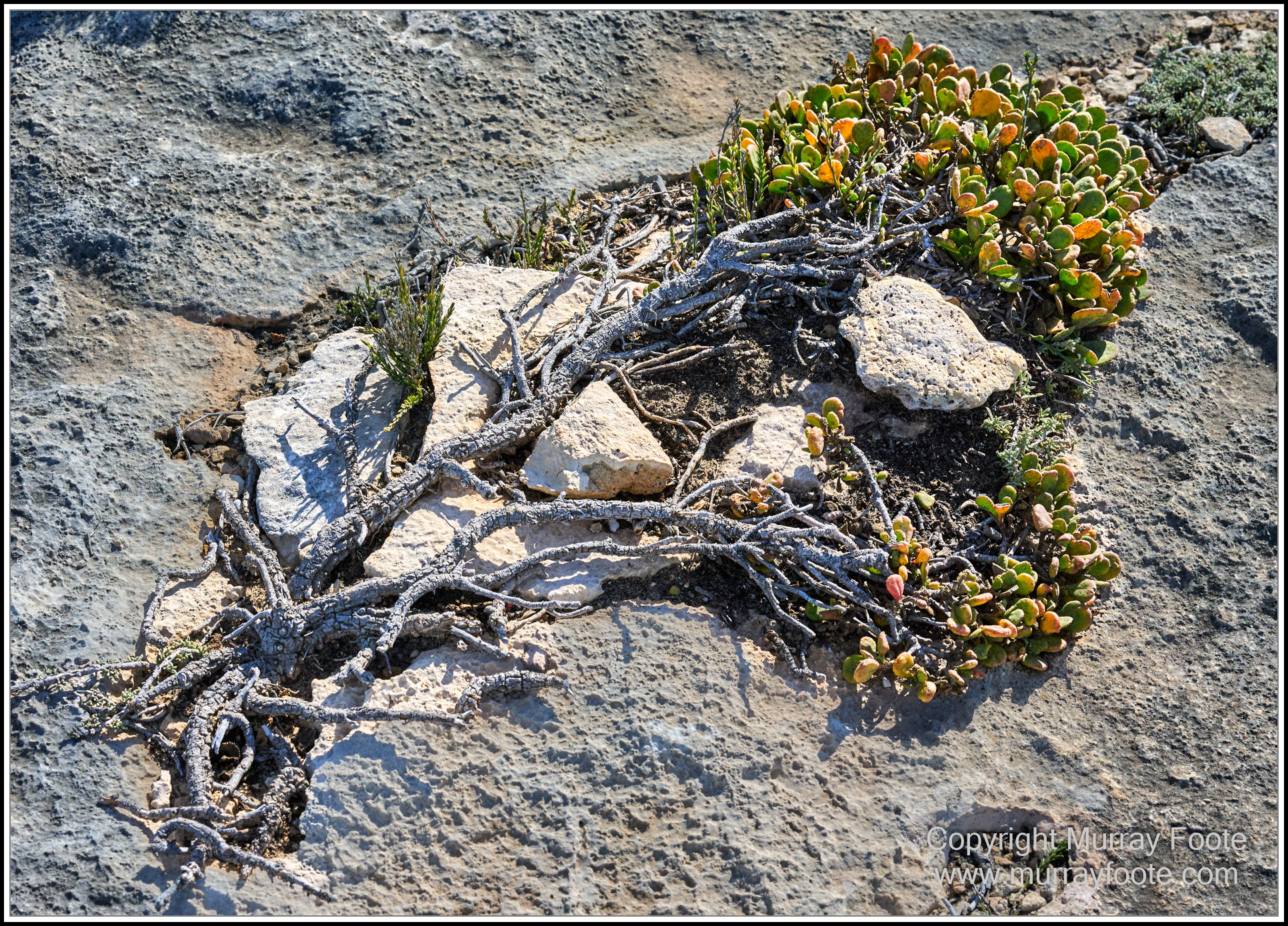
“The shallow soils, strong winds and salt spray make life tough for plants. Only salt-tolerant plants are able to survive the constant spray on the coastal slopes. The plants that grow here have a ‘salt-pruned’ shape – the foliage on the seaward side is raggard while the growth on the inland side is lush so the plants look uneven”.
“Life is tough enough for plants in this environment. Even the slightest interference from people can kill them”.
.
.
.
. 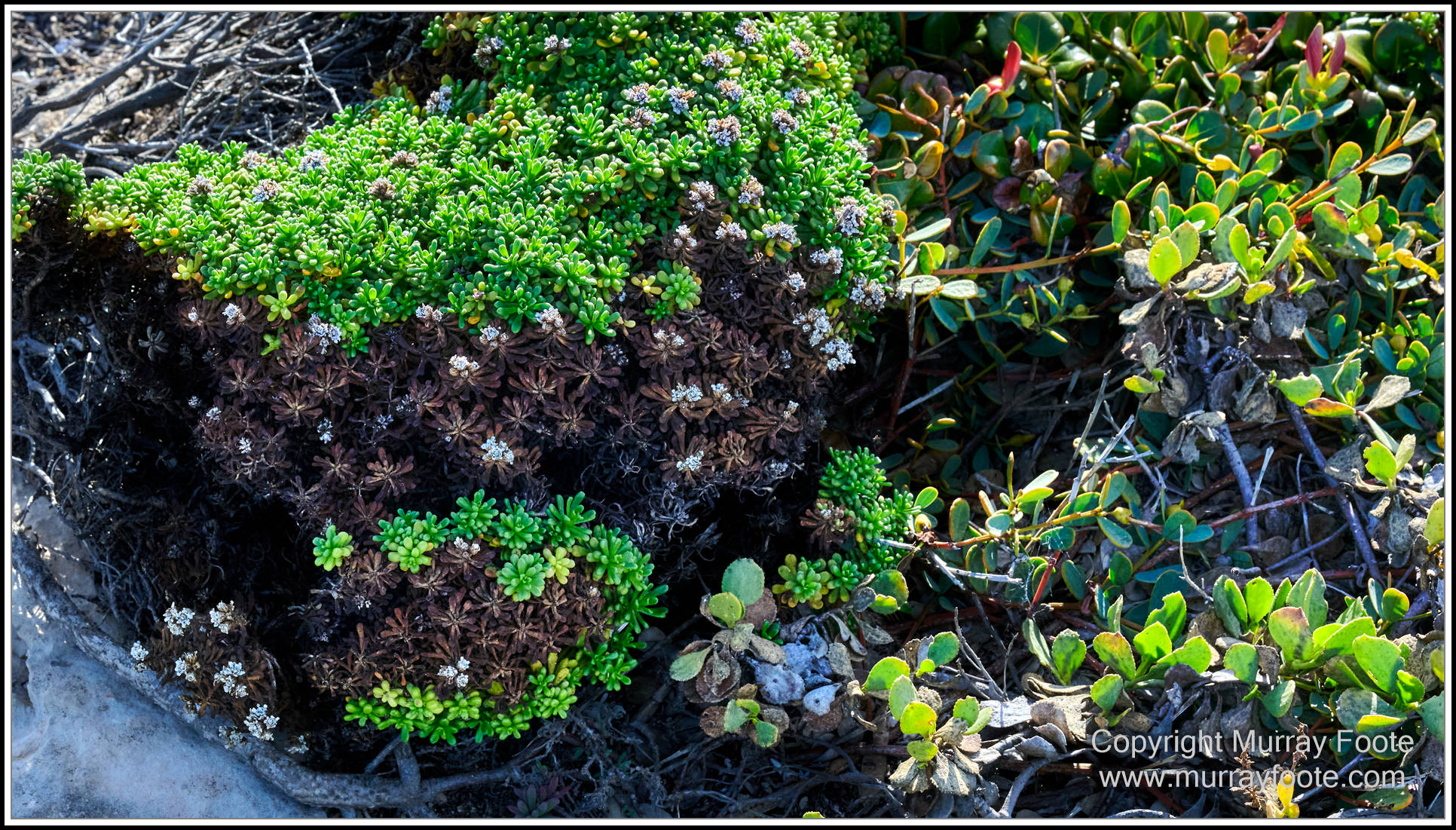
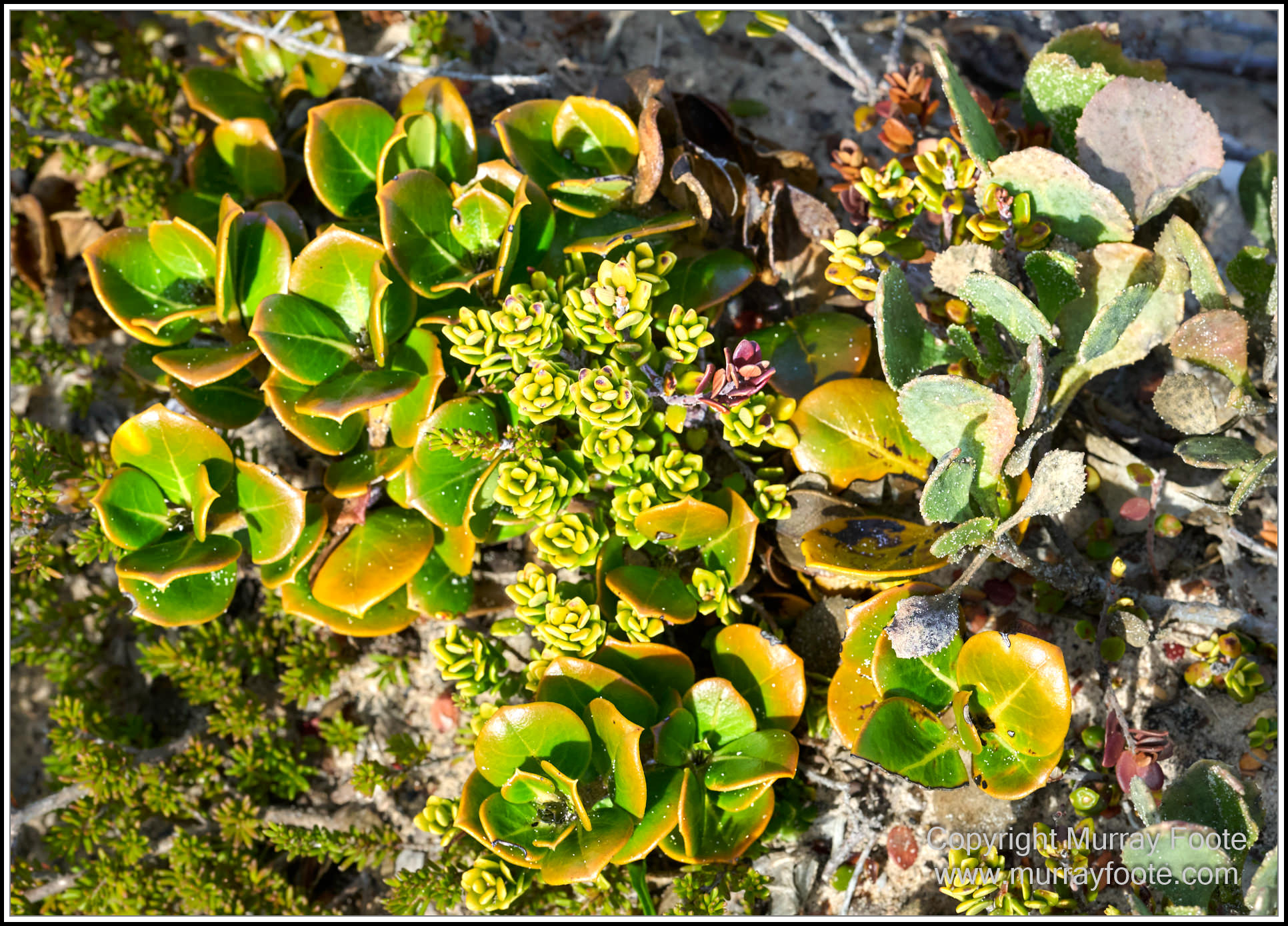
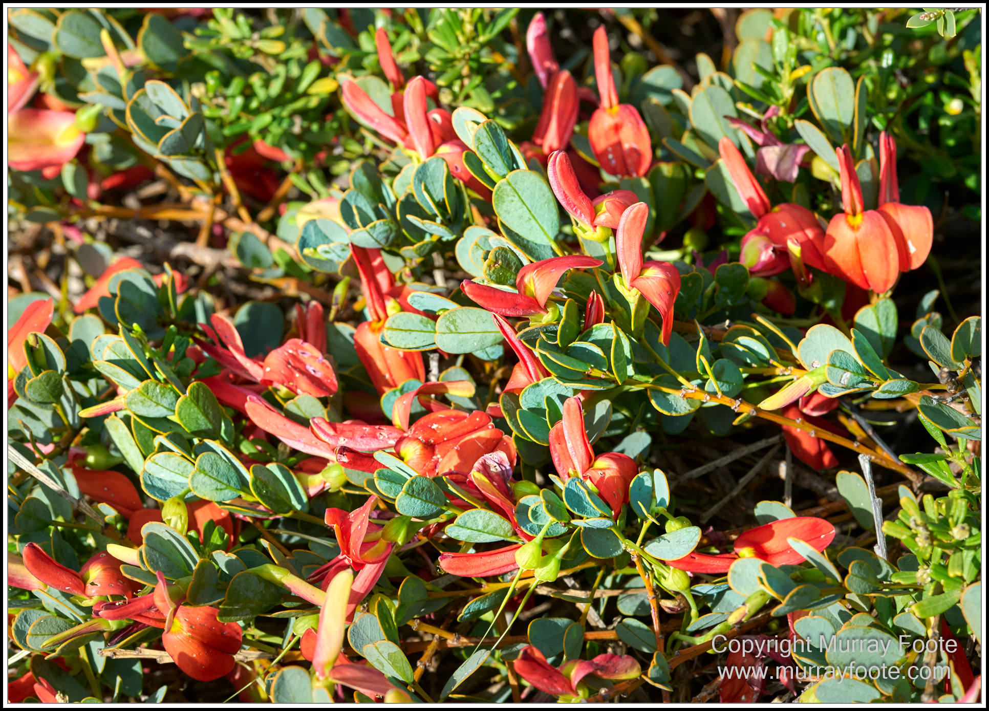
Lots of miniature natural gardens….
.
.
.
.  .
.
.
.
. 
A cairn near the lighthouse. Wedge Island and its lighthouse in the distance, about 30 kilometres away.
.
.
.
. 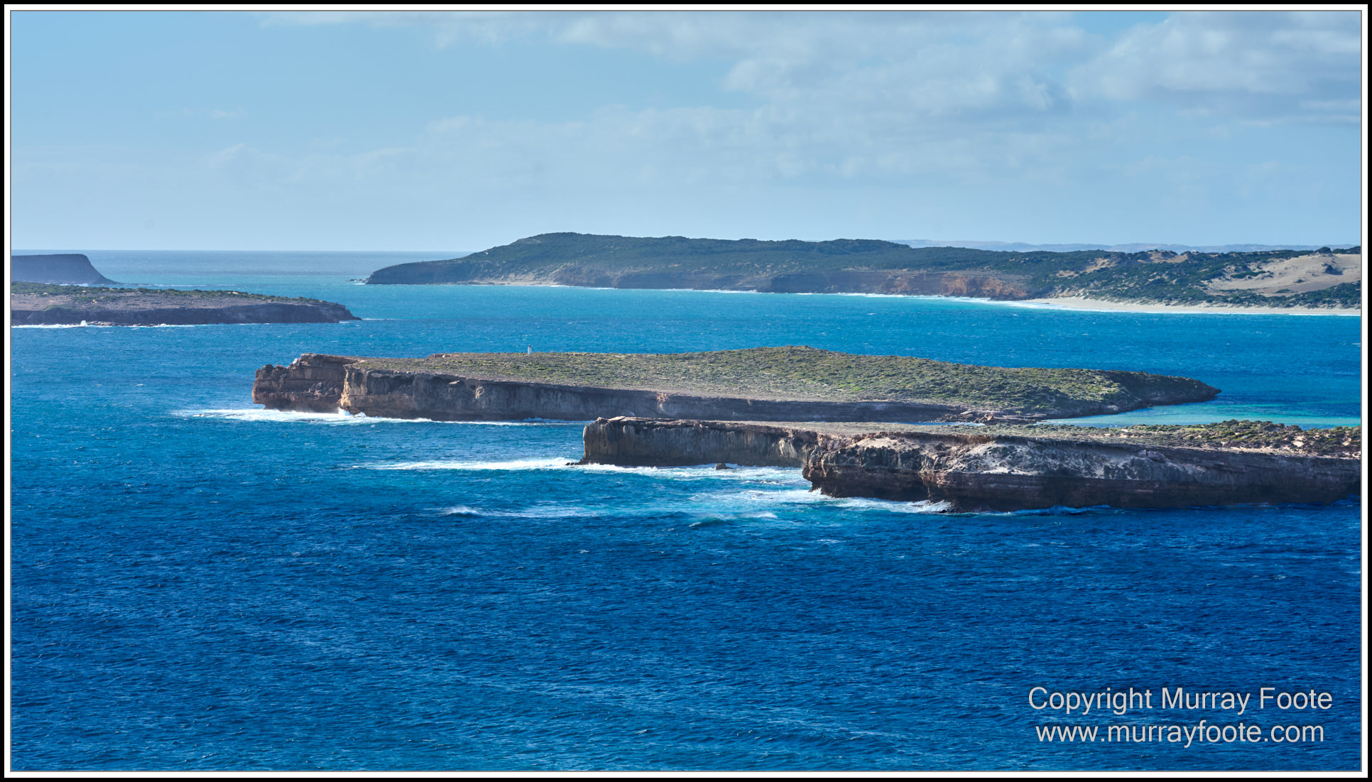
From bottom to top: Pondalawie Bay Lookout (peninsula unnamed), South Island, Middle Island, Royston Island and Royston Head. You might see that South Island has a beacon on it. Too small to call it a lighthouse..
.
.
.
. 
Western Grey Kangaroo (who has chosen to redefine grey), near Pondalowie Bay Lookout.
.
.
.
.  .
.
.
.
.
.  .
.
.
.
. 
Coastline from Pondalowie Bay Lookout.
.
.
.
. 
Pondalowie Bay Fishing Village and West Cape in the background.
We must be at Pondalowie Bay from Casuarina Campground access.
The small fishing village was built in the 1950s but is entirely in the national park and cannot be expanded. The fishing is mainly for rock lobsters. The islands protect the entrance of the bay, making it an ideal place to moor boats.
.
.
.
. 
It might look like a dead car but it’s a dead boat.
.
.
.
. 
North end of Pondalowie Bay.
.
.
.
. 
Looking back towards West Cape.
.
.
.
. 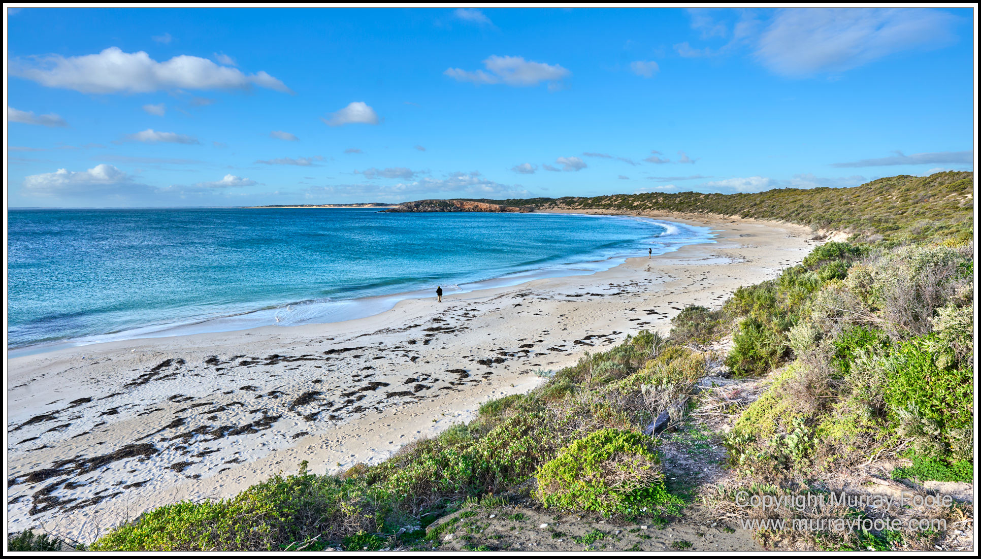
Dolphin Beach.
Some of the beaches can get quite crowded. There are two people on this one. Both appear to be fishing, or staring into the distance while carrying a fishing line.
.
.
.
. 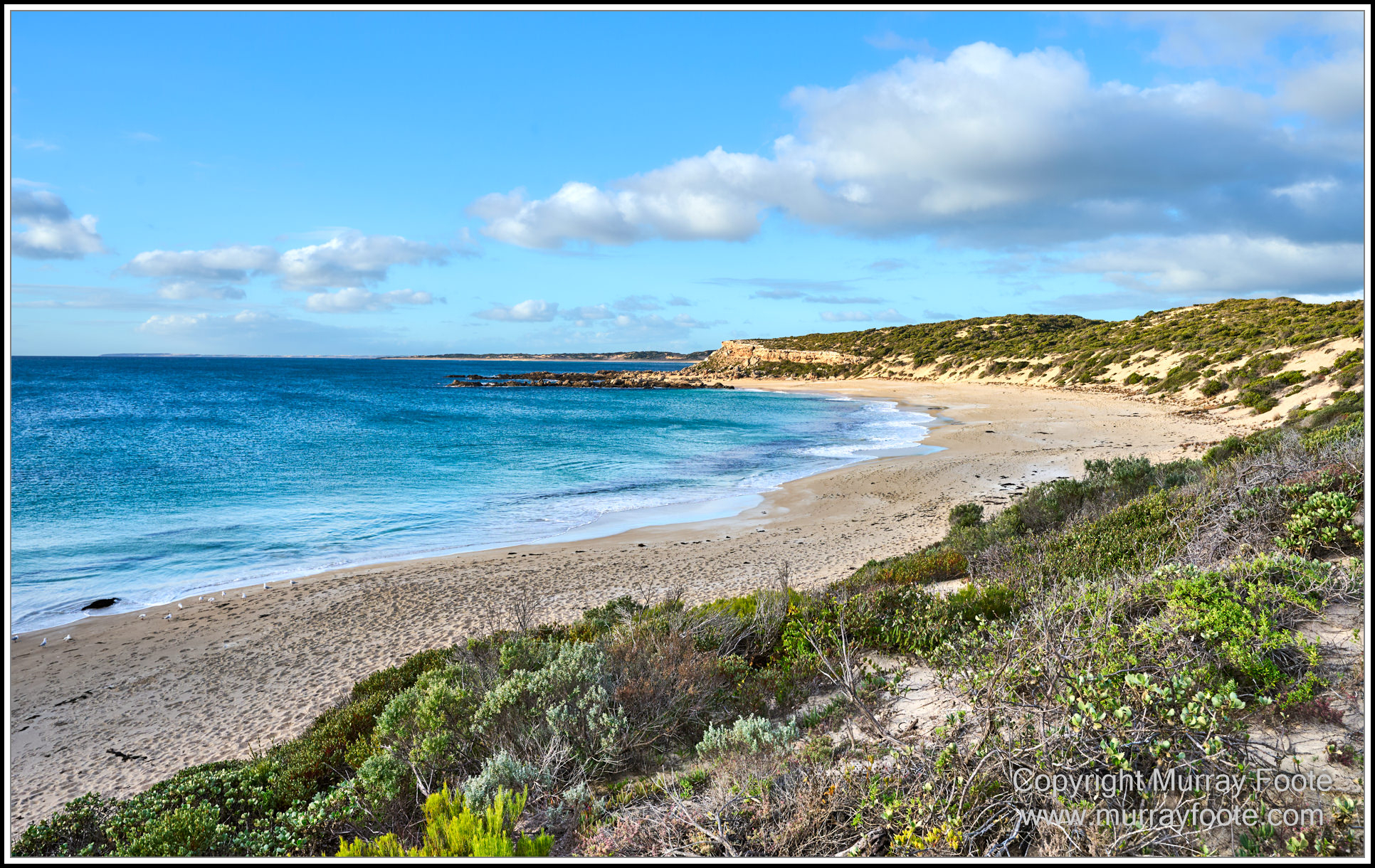
Shell Beach.
… still, if a beach gets too crowded, you can always go to the next one….
.
.
.
. 
Old fishing shack near Brown’s Beach.
.
.
.
. 
Brown’s Beach.
You can drive right down here, hence the tyre tracks on the beach (not for us though). Quite crowded too. Seven people on this one.
.
.
.
. 
Getting late. Time to turn around.
.
.
.
. 
Back near Inneston, Cape Spencer Lighthouse again and Althorpe Island behind.
.
.
.
.
(The next post may be delayed a bit. It’s an infrared one which can be time-consuming and I have a lot of live music images to process).
.
.
