11th October 2015. Reunion to Madagascar.
.

Notwithstanding the title of this post, this is still Reunion, leaving Roland Garros Airport at the Capital of St-Denis, bound for Antananarivo (commonly known as Tana), the Capital of Madagascar. Madagascar is the world’s fourth largest island and has six climatic zones, ranging from rainforest to desert.
.

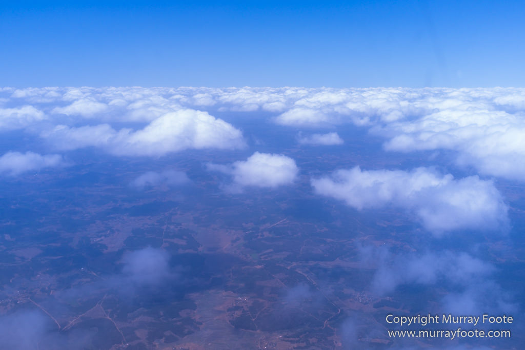
Two hours later, over Madagascar, the thick cloud layer parts to allow glimpses of the ground.
Madagascar has been drifting aimlessly in the Indian Ocean for a minor eternity. It separated from Africa around 135 million years ago, conjoined with India (Well, to be precise, it separated from Africa and South America which were then conjoined). Then 90 million years ago, Madagascar had a tiff with India. India took off north in a great huff and ended up colliding with Asia, creating the minor disturbance known as the Himalayas. Madagascar still needed at least a suggestion of company so it hung out in about the same position near Africa.
.
You might need to click on the image to see this but the land below has roads and the occasional buildings with swathes of cultivation (rice paddies) interspersed amongst forest.
From 90 million years ago, Madagascar preserved an amazing time capsule of unique flora and fauna, some of which arrived after the separation from Africa and some of which still survives. The first humans arrived around four thousand years ago from Indonesia. A small minority of the population on the west coast also has African roots and an even smaller minority of the population has Arab roots. At the time of the first arrivals, Madagascar had many now extinct species including giant lemurs weighing up to 160kg (350lb), and elephant birds, the largest of which may have been more than three metres tall and weighing up to 500kg (1,100lb). There were also dwarf hippos and several species of giant tortoise. It is just possible the dwarf hippos may survive in a remote location according to some stories of the natives.
.

Getting close to Tana, now.
Although much has gone and the pressures of humans and agriculture are considerable, there still remains an amazing kaleidoscope of unique endemic wildlife, as we will see in some of the following posts. In many cases, though, valuable species are trapped in small enclaves, so the conservation challenges are vast. The flora is also incredibly diverse. We will, for example be seeing some baobabs.
.

Ivato International Airport is beside the runway and in front of the smoke. The 25 story building beside the lake was built between 2008 and 2012 to be a luxury Sheraton hotel. The Sheraton involvement was scuppered due to the 2009 coup and consequent general political disintegration. I think it’s unused because there are no cars in the parking lot.
Madagascar is one of the poorest countries on Earth. According to Wikipedia, it ranks 179 out of 186 (IMF), 171 out of 183 (World Bank) or 188 out of 199 (CIA). Income per capita ranges from $US1440 to $US1500, which means the average person survives on $US4 per day (and as for the really poor…).
.

The plane must have gone into a holding pattern waiting for its turn to land. We are just outside Tana now.
Visiting Madagascar means you need protection against a melange of tropical diseases. There was even bubonic plague in Tana the year before I visited.
.

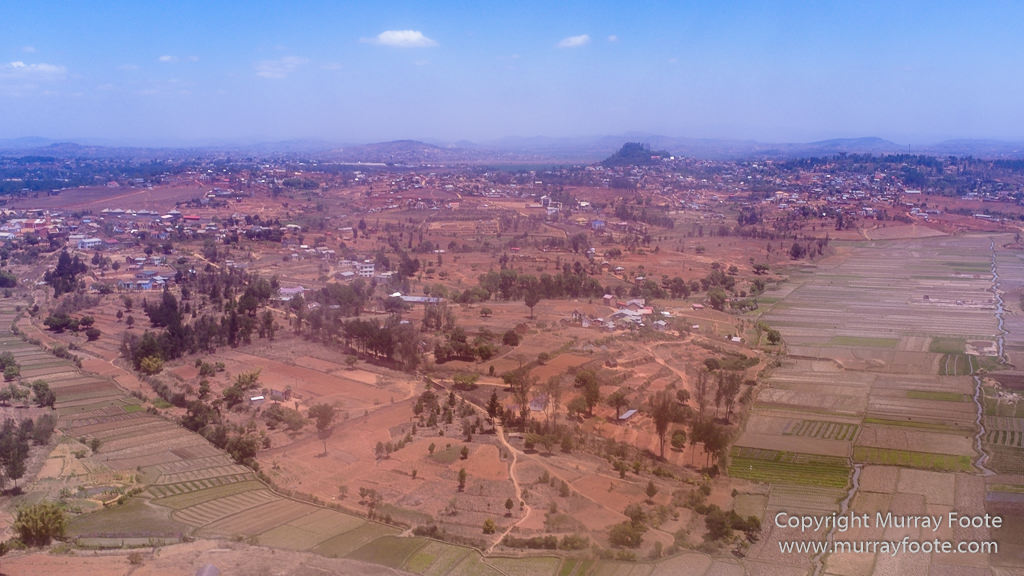
You can see the cultivated areas in the lowlands. These are rice paddies.
.

We are now some distance from the airport. You can see that smoke in the distance, where the airport is.
.

You can always click on the image if you want to see more detail. We can see here some terracing for the rice paddies.
.

We are still outside Tana, with not many dwellings.
.
Coming back into Tana now.
.

Cultivation of rice on river flats and lowlands continues right into the middle of Tana.
.

It looks rural but we’re about to land (though admittedly, the airport is out on the edge of town).
.

great post
LikeLiked by 1 person
Whoops, I forgot to reply! Thanks heaps!
LikeLiked by 1 person
welcome
LikeLike
Pingback: Journey to Madagascar and South Georgia Island – Itinerary and Links to Posts « Murray Foote