St Kilda, Outer Hebrides, Scotland. Day 20 , 18th July.
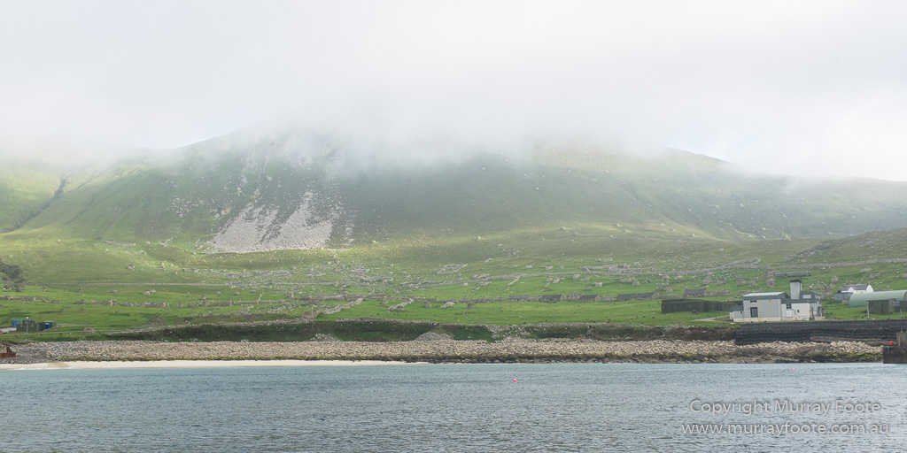
Early in the morning, before we left, I took some shots of Village Bay from the ship. This first one is a wide angle and you can see some naval buildings in front on the far right and a little of them on the far left. “The street” stretches across the middle, with stone fences, enclosures and cleits behind. (You can always click on the image to see that better). There’s still some fog but the weather is much clearer than either of the previous two days.
Much of the sea wall at the top of the bank behind the “beach” was demolished by the navy years ago but remember that after the huge storm of 1860 the houses along “the Street” were knee-deep in water.
.
This image and the following ones were picked off with a 300mm lens, though some combine multiple images for a panorama. This shows a little of the density of cleits, walls and enclosures behind the houses.
.
The cleits and enclosures continue behind the “head dyke” or back wall.
.
A view of the Feather Store from the front and the wharf in front of it (with the tide out). You can see why landings can be difficult in rough weather.
.
Lady Grange’s house in the mid left foreground. Behind that is the street and behind that the cemetery. You can see the cemetery gate if you click on the next image and zoom in, though you can only really see the front wall of the cemetery.
.
The image above is a panorama comprising six images. You won’t see much detail in it as it sits on this page, but you will if you click on it. If you click on any image in the Blog you’ll see a larger one, but in this case you go to a huge image that you can zoom into.
.
The cleits continue up the hills and beyond the horizon.
.
Our last glimpse of Village Bay – these are some enclosures on the cliffs of Hirta near Dun, just south of the village.
Looking back from the North-East coast of Hirta. Village Bay is out of sight behind the headland and Dun is in the distance at the left.
.
.
These are two stacks and a corner of the island of Boreray, some miles away. Stac an Armin, on the left, is where three men and eight boys survived for nine months when the smallpox epidemic laid waste to the residents at Village Bay on Hirta.
.
There’s a small line of black-and-white guillemots perched on a ledge high inside the wall of the sea cave.
.
This is our last glimpse of settlement on Hirta. The creek is called Abhainn a’ Ghlinne Mhoir and the area is Gleanne Mor. If you look closely there are a number of cleits in the landscape. To the left of the creek, out of sight here, there are the remains of a number of interesting structures. These include sheilings, or summer huts and the “Amazon’s House” (Taigh na Banaghaisgeich), thought to be a Pictish-era residence dating from 400AD to 900AD. Mind you, there should also be sheilings within our field of view, though you’d have to be walking around to have a chance of identifying them.
.
.
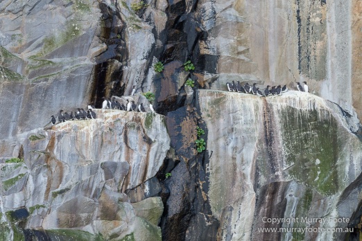
Not so long ago, the inhabitants of St Kilda would have lowered themselves down these cliffs on homemade ropes and swung sideways to get to the birds and their eggs.
.
The birds are guillemots.
.


Pingback: Journey to North Atlantic – Itinerary and Index of Posts « Murray Foote
What a fascinating slice of history you’ve shared with these images.
Thanks for the ‘visit’.
LikeLike
Thanks very much Vicki.
LikeLike